


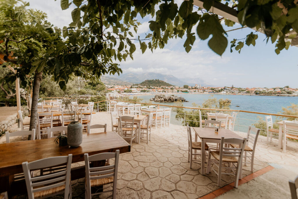
Stoupa sits on a peninsula that changes character every twenty kilometres you drive south. Within an hour you can go from olive terraces and a gorge running down off Taygetos to a treeless landscape of stone towers, and then to the southernmost point of mainland Greece — a cape the ancient Greeks believed was an entrance to the underworld.
Most of it fits into a day, provided you choose. Here is what is out there, how far it actually is, and which combinations work.
What “Outer Mani” actually means
Worth getting the terms straight, because guidebooks and road signs use them inconsistently.
Mani has three traditional regions: Outer Mani (Έξω Μάνη, Exo Mani) in the northwest, Lower Mani (Κάτω Μάνη) in the east, and Inner Mani (Μέσα Μάνη) in the southwest. Outer Mani corresponds roughly to today’s municipality of West Mani, which sits in the regional unit of Messenia and has its administrative seat at Kardamyli — which is why you will also see the area called Messenian Mani. Stoupa is in it.
The old dividing line runs from Itylo across to Gytheio. North of it is Outer Mani; south of it is what people call Deep Mani. The distinction is not bureaucratic. Outer Mani is far more fertile, and — this is the part most travel writing skips — clan rivalry here was never as intense as it was further south, so the towers do not look as grim. Drive south and you watch the landscape lose its trees and get serious.
Kardamyli, and the gorge behind it
Kardamyli is the nearest stop worth making, roughly eight kilometres up the coast.
It is old. Homer lists it in Book 9 of the Iliad as one of the seven cities Agamemnon offered Achilles to bring him back into the war. The part worth walking is Pano Kardamyli, the old settlement above the modern village: the buildings date to Venetian times, and many were put up by the Nikliani clans, the medieval aristocracy of Mani. The church of St Spyridon is up there.
Just outside the village, at Kalamitsi, is the house the writer Patrick Leigh Fermor built and lived in for most of his later life. He and his wife Joan gave it to the Benaki Museum in 1996 on the condition that it stay open to the public. It is — but only for a couple of scheduled hours a week, and tickets have to be bought online in advance. Turning up unannounced does not work.
Behind Kardamyli, the Viros Gorge comes down off Taygetos. It runs about twenty kilometres, and the Royal Road that connected ancient Sparta to the port of Kardamyli passed along it. You do not have to walk the whole thing — a marked route through the gorge takes about two and a half hours, and it can be picked up from Exochori as well as from the coast.
If you would rather walk than drive, there is a marked footpath from Kardamyli back to Stoupa: 11.9 km, about three and a half hours, 350 m of climbing, through the hamlet of Petrovouni and the village of Proastio. It is not a shortcut. That is not what it is for.
The tower houses, and how to read them
Medieval Mani was known as Maina Polypyrgos — “Many-Towered Maina”.
The towers are the thing people photograph and the thing most often explained badly. They are not castles and not decoration. They are built of local stone, tall, narrow and unadorned, with window slits just wide enough to take a musket. They exist because outside authority was unreliable and feuding between clans was constant, so families fortified the house they already lived in and fought from it. Some run to eight or ten storeys.
Once you know what you are looking at, the drive south stops being scenery. The towers get taller, closer together and plainer the further you go from the fertile ground — the architecture is a map of how bad things used to get.
Areopoli and the Diros caves
Areopoli is 40 km from Stoupa: call it an hour on roads that are well surfaced but wind constantly. You pass Itylo (32 km) and Limeni (36 km) on the way.
This is where Deep Mani starts, and arguably where the Greek War of Independence did. Petrobey Mavromichalis, the last bey of Mani, launched the 1821 revolution in his hometown on 17 March — eight days before the official date. The main square is named Platia 17 Martiou 1821, and the cathedral on it, the Taxiarches, was built by the Mavromichalis family in the second half of the 18th century. It has the tallest belltower in Mani.
South of Areopoli, at Pyrgos Dirou, is the Diros cave — Vlychada. Some 14,700 metres of it have been mapped, with submerged sections reaching 80 m deep. What you actually see is a 1,500 m, roughly 25-minute route, most of it in a boat on the underground lake, through chambers named the Mantle of Poseidon, the Great Curtain, the Lake of the Fairies and the Sea of Shipwrecks. Locals found it in 1923; systematic exploration began in 1949; it opened to visitors in 1967. Two hundred and twenty metres away is Alepotrypa cave, inhabited from the middle of the 6th millennium BC until 3200 BC and not open to the public.
It is cool inside, year-round. In August that is not a minor detail.
Cape Tainaron: the end of the map
This is the long one, and you should decide before leaving Stoupa whether you are doing it.
Cape Tainaron — Matapan — is the southernmost point of mainland Greece and of the Balkan peninsula. From Areopoli it is about another hour south, past Vathia, a fortified village whose towers stand on a hillside above the sea, and down towards Porto Kagio. Given that Areopoli alone is 40 km from Stoupa and the cape lies well beyond it, this is not a stop on a route. It is the whole day.
Then the road ends and you walk. The path starts by the Byzantine chapel of Agioi Asomatoi, which was built on the remains of the sanctuary of Poseidon Tainarios; there are ancient mosaics in the ground along the way. About thirty minutes on foot brings you to the lighthouse, built by French engineers in 1882 and renovated in 1950. The walk is roughly 4.2 km in total, with no serious climbing — children manage it.
The cave near the shore is why the place is in the myths at all: the ancient Greeks held it to be an entrance to Hades. Heracles was said to have dragged Cerberus up through it for his twelfth labour, and Orpheus to have gone down through it after Eurydice. There is no monument and no ticket booth. It is a cave, a lighthouse and a great deal of sea — and one of the few places in Greece where the mythology and the geography visibly agree with each other.
Planning it from Stoupa
Three itineraries that actually hold up:
Half day, north. Kardamyli and the Viros Gorge. Eight kilometres up the road; back by lunch, or by late afternoon if you walk the gorge.
Full day, south. Areopoli (40 km) and the Diros cave. Leave in the morning, back for dinner. This is the standard day out and it works.
Long day, to the end. Cape Tainaron. Leave early. You can take Areopoli and Diros on the way if you are disciplined, but do not plan all three plus a swim.
What does not work is the whole peninsula at once. It is 40 km from Stoupa to Areopoli and roughly that again to the cape, on roads that punish optimism. Pick one direction.
Either way you come back to Stoupa — a village of 638 people at the 2021 census, which is smaller than the day you have just had. If you have not walked it properly yet, the first-timer’s guide to Stoupa covers the beaches and the layout, and the bust of Nikos Kazantzakis on the cliff above Kalogria beach has a story behind it — told in the piece on the real Zorba and Stoupa.
For the evening: Liastres Traditional Restaurant is family-run, on Tampoureas street on the headland at the edge of the bay, cooking Mani recipes from local seasonal ingredients, with the Messenian Gulf in front of it. There is a fuller rundown of the options in where to eat in Stoupa. Forty metres up the same street, Enigma Cocktail Bar takes the sunset end of the evening.
Reservations are by phone only — details on contact — and directions are on the location page.
Book the table before you leave in the morning. After Tainaron you will not want to negotiate.